(Scary) satellite images of our planet in time-lapse
"A picture is worth a thousand words" said Confucius (well he also said a whole bunch of crap eh). It fits to start an intro, but it is also surely what the people of Google said for the project "Timelapse" that they have just launched. The idea? Use the satellite images of the past 28 years to show the impacts of our development on planet Earth. It's exciting ... but a little frightening.
The drainage of Ourmia Lake (Iran)
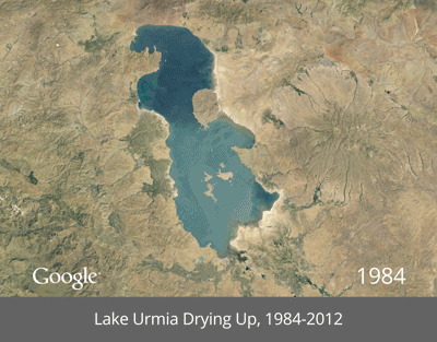
Photo credits: Google
Deforestation of the Amazon (Brazil)
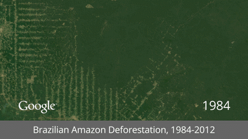
Photo credits: Google
Columbia Glacier retreat (Alaska, USA)
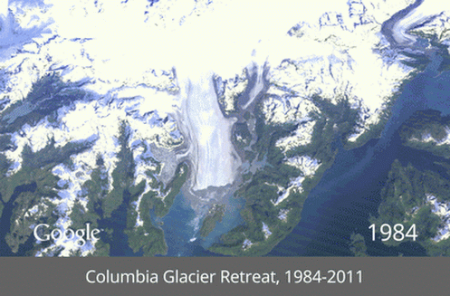
Photo credits: Google
The Urban Expansion of Dubai (United Arab Emirates)
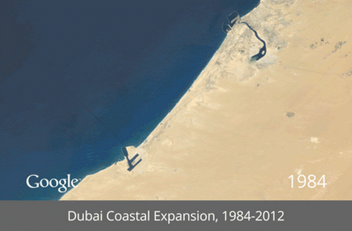
Photo credits: Google
The development of irrigation (Saudi Arabia)
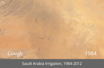
Photo credits: Google
The operation of a Coal Mine (Wyoming, USA)
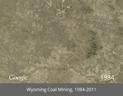
Photo credits: Google
Las Vegas Urban Expansion ... and the drying up of Lake Mead (Nevada, USA)
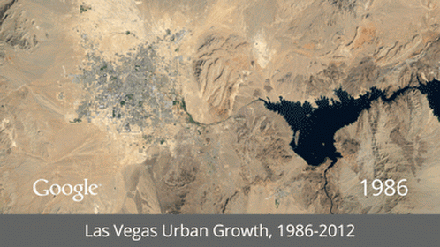
Photo credits: Google